

Project
Great Dunmow
Chelmer View, Great Dunmow is located south east of Great Dunmow between the B1256 Braintree Road and the A120 dual carriageway, and only 8 miles…


200 dwellings

25 acres

Land under promotion

Bristol
Land acquired

Land under promotion

Planning application submitted

Planning application granted

Infrastructure commenced

Land sold to housebuilder

Sites under construction

Development complete

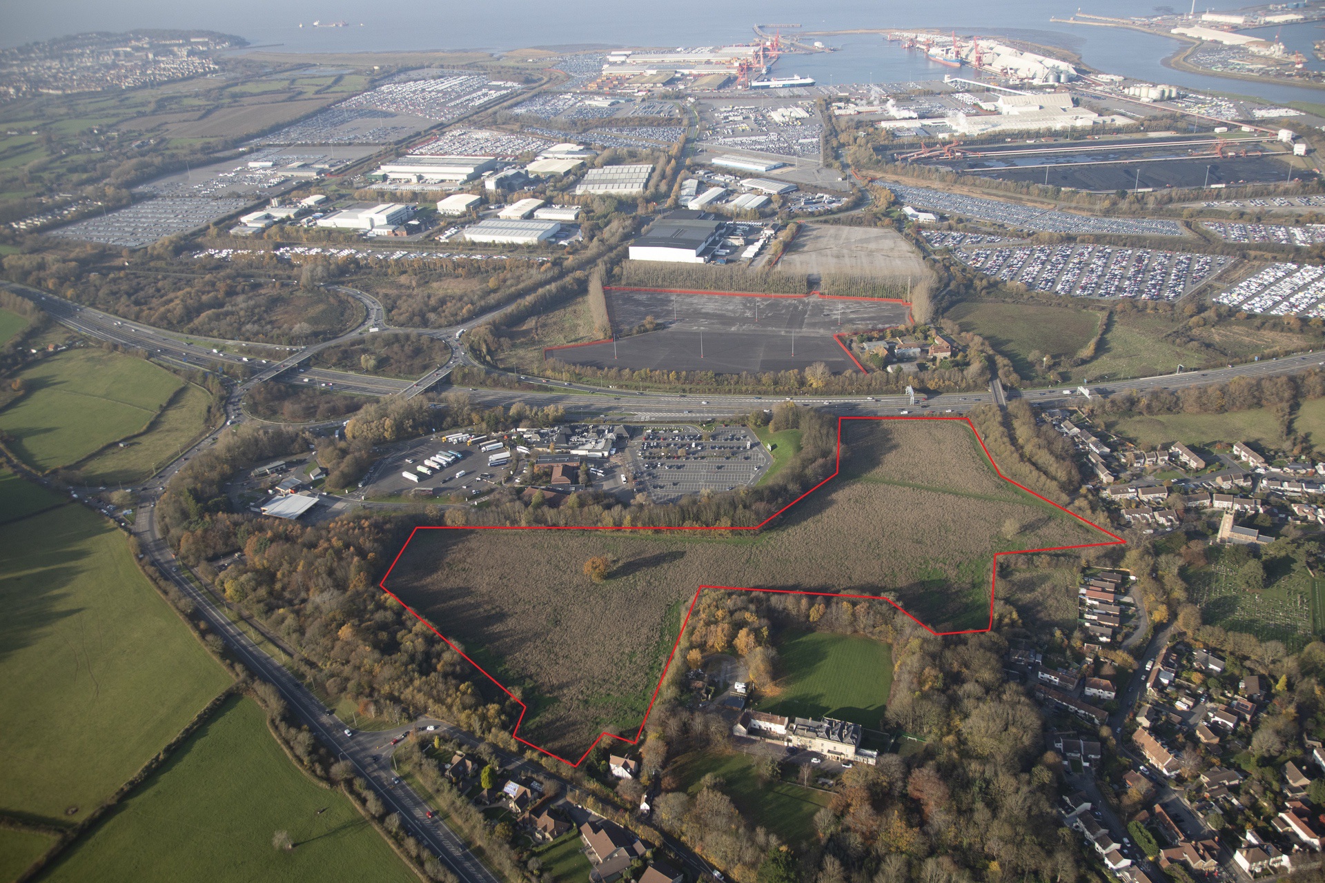
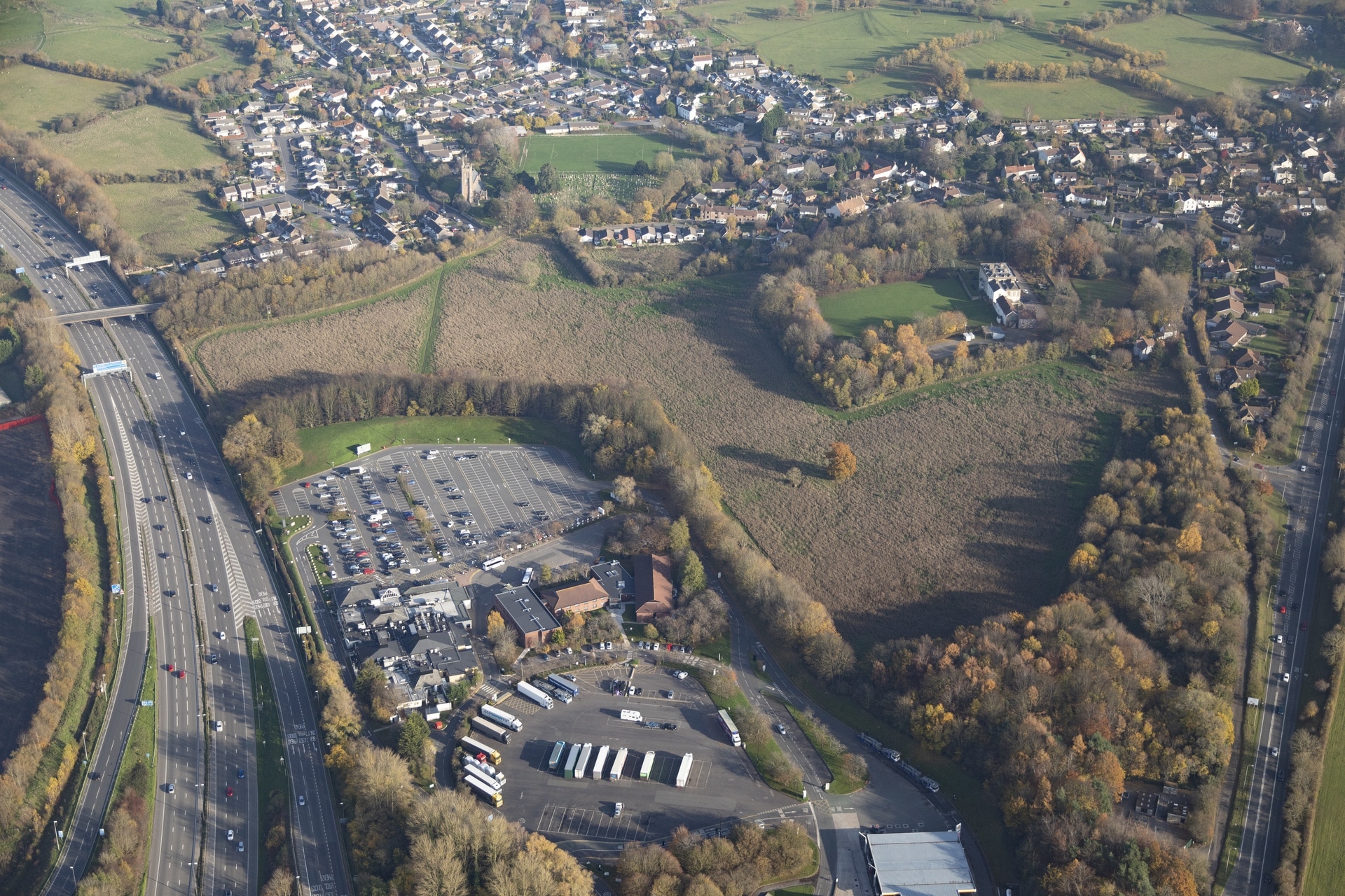
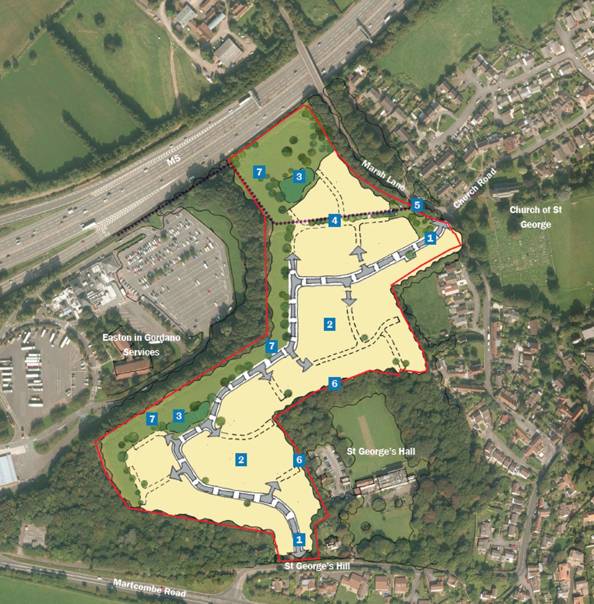
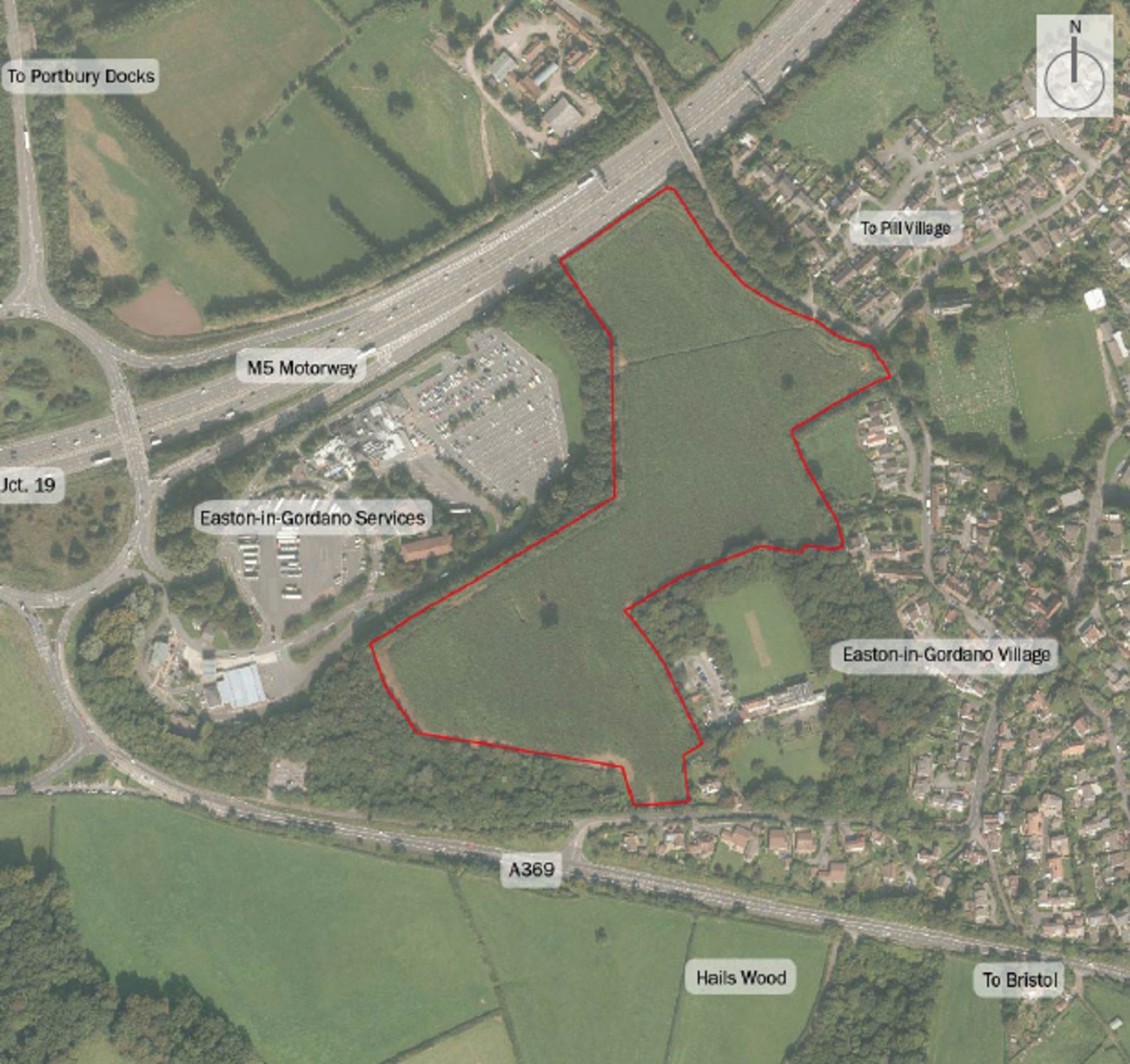
The Court House Farm site covers just over eight hectares of greenfield land, at the edge of the village of Pill and just five miles from the centre of Bristol. The site is currently designated as within the Bristol metropolitan Green Belt. Lands Improvement is promoting the site for release through the emerging North Somerset Local Plan, in order to accommodate approximately 200 dwellings.
Pill is a large village on the eastern edge of Bristol, benefiting from an abundance of day-to-day amenities for a settlement of its size. It will also benefit from the recreation of a station (previously closed in 1964 as part of the Beeching cuts), which will provide services on the Portishead branch line into Bristol Temple Meads. Just over the M5, off junction 19 lies the Royal Portbury Dock, a major employer in the region.
Following the rejection of the West of England joint spatial plan, North Somerset council has focused on progressing its own local plan, to direct new growth within its boundary. Lands Improvement continues to work with the council to achieve an allocation within the emerging local plan, highlighting the limited role the site plays for the purposes of the Green Belt, while emphasising its sustainability credentials.
The council is currently targeting publication of its Reg 19 draft local plan by the end of 2022, before its submission for examination in 2023. If a draft allocation can be secured, Lands Improvement can look at options to pursue an outline planning application, with a target determination alongside adoption of the Local Plan.
Located to the west of Bristol just off the M4 and behind the Gordano Service Station.
Our vision for Linmere is to create a truly great place to live, which people are proud to call home and where they can enjoy…
